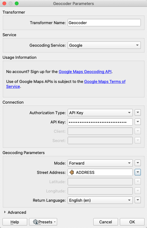
After completing this lesson, you'll be able to:
Sometimes your dataset will only contain addresses without latitude/longitude data. To handle these kinds of situations, you can use the Geocoder transformer.
The following services are supported:
Service | Mode |
ArcGIS Online | Forward, Reverse |
ArcGIS Server | Forward, Reverse |
Bing | Reverse |
Geocode.Farm | Forward, Reverse |
Geocoder.ca | Forward, Reverse |
Forward, Reverse, Elevation, Timezone | |
HERE | Forward, Reverse |
IPInfo.io | IP Address |
ipstack | IP Address |
OpenCage | Forward, Reverse |
OpenStreetMap | Forward, Reverse |
TAMU | Forward, with census region information |
Some Geocoder services support "reverse geocoding," finding the nearest address given a coordinate. Note also that the exact address formatting that will give you the best chance of successfully geocoding will vary by service. Refer to the service's documentation and use an AttributeManager or other transformers to ensure you are giving the transformer an address format it expects.
The output of point features using any of the three methods. Stylized in FME Data Inspector using map tiles by Stamen Design, under CC-BY-3.0. Data by OpenStreetMap, under CC-BY-SA.